MINE of MOYEUVRE-GRANDE - France
Mining activities are in decline, and not only in Germany. Mines are being closed down all over the world. But what exactly happens to the tunnels, galleries and shafts? Occasionally, stories surface in the press about abrupt subsidence or, as recently happened in France, the flooding of cellars in houses located in a valley in a former mining region. In March 2004, Nordseetaucher was contracted by INSERBAT of Forbach, France, to investigate the cause of the increasing water pressure in the vicinity of a decommissioned mine.
The iron ore mine in Moyeuvre Grande, located between Metz and Thionville in France, was closed down in 1977. Initially, all went well: the water that flowed out of the hill was pumped away by drainage pumps without any problems occurring. Then, unexpectedly, houses on the hill gradually started to subside. They were evacuated and locked up. The cellars and basements of the low-lying houses further down in the valley started flooding regularly. The pumps in the mine were failing to pump away the water collecting in there and nobody was able to explain exactly where all the water was coming from.
 The owner of the mine, the mining authorities and the town council of Moyeuvre Grande were anxious to get to the bottom of this problem, but as the shafts below a certain depth were flooded, there was no other option but to bring in diving experts and ROV cameras (remotely-operated vehicles) to survey the mine.
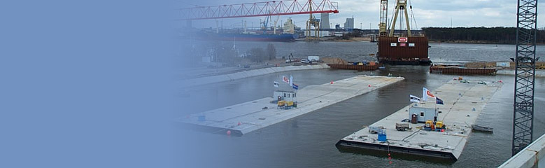
With our diving expertise and experience of projects in mines we were approached by the French contractor and asked to carry out this mission. The entry point for the shaft was located in the vicinity of the town's railway station, at the bottom of a hole in the pavement in the middle of a residential area. Below the pavement there was a 1-metre wide tunnel which led to an entry tunnel to the main shaft which had a ceiling height of 2.5 metres. We set up our operational centre in this entry tunnel; the entire mission was monitored and controlled from here. A ventilation system was installed; a mobile plastic pontoon was let down in sections and assembled below ground; the computer for controlling the "Hyball" ROV - a remotely-operated camera, the sonar equipment and the diving gear were all brought down and installed.
The initial survey, carried out by Andreas Stutz with the aid of the "Hyball" ROV, showed us that we would not be able to get into the gallery below the tunnel. ROV "Hyball" We then guided the camera along the tunnel for 100 metres to where the next passageway branched off, where entry was possible after a few large rocks had been cleared by the ROV. The diver prepared to pass the cable of the ROV over and through this very difficult section of the passage. Once this had been completed the camera was able to continue deeper and deeper into the mine, sending back images of its surroundings. At places that appeared to be relevant or whenever we had no clear idea of how to continue, we would switch on the sonar equipment, which provided us with a precise image of the immediate vicinity.
 Using this method, we examined four tunnels; the furthest point away was 245 metres from the entrance. Throughout the mission the diver was submerged in the passage and went 120 metres into the interior of the hill. We did not detect any signs of major shaft collapses. Water samples taken by the divers will be examined to see if they can shed any light on the origin of the water that keeps flooding down into the valley.
MINA de MOYEUVRE-GRANDE – Francia
No sólo en Alemania, sino en todas partes del mundo está decreciendo la actividad en las minas y se cierran muchas de ellas. La pregunta sin embargo es qué ocurre con los túneles, las galerías y los pozos. De vez en cuando la prensa saca a la luz historias sobre súbitos hundimientos o, lo que sucedió en Francia, que se inundaron los sótanos de casas situadas en un valle de una otrora región minera. En marzo de 2004 Nordseetacher fue contratada por INSERBAT de Forbach, en Francia, para investigar las causas del incremento de la presión del agua en las proximidades de una mina fuera de servicio.
La mina de hierro en Moyeuvre Grande, localizada entre Metz y Thionville en Francia se cerró en 1977. Al principio todo fue bien: el agua que emanaba de la montaña fue bombeada sin que surgieran problemas. Pero inesperadamente las casas de la montaña comenzaron a hundirse. Sus habitatantes fueron evacuados y las casas cerradas. Los bajos y sótanos de las casas situadas más abajo comenzaron a inundarse. Las bombas en la mina no conseguían extraer toda el agua que se acumulaba allí y nadie podía explicar de donde exactamente provenía tanta agua.
 El explotador de la mina, las autoridades mineras y el concejo municipal de Moyeuvre Grande querían por todas llegar al fondo del problema, pero así que los pozos por debajo de una determinada profundidad estaban inundados, no había otra opción que no fuera llevar buzos expertos y cámaras operadas a distancia (ROV) para examinar la mina.
Debido a nuestra experiencia con trabajos de buceo en la minería, los responsables del proyecto nos pidieron llevar a cabo esta misión. La entrada del pozo estaba localizada en las proximidades de la estación ferroviaria de la ciudad, en el fondo de un agujero en el pavimento en medio de una zona residencial. Por debajo del pavimento había un túnel de 1 metro de ancho que llevaba a una entrada del túnel en la galería principal, cuyo techo tenía una altura de 2,5 metros. Montamos el centro de operaciones en esta entrada del túnel y desde aquí toda la misión pudo ser monitorizada y controlada. Se instaló un sistema de ventilación, un pontón móvil de plástico se bajó a piezas y se montó bajo el suelo, una computadora para el control del “Hyball” ROV, la cámara operada por remoto, el sonar y el equipo de buceo, todo ello fue bajado e instalado.
El reconocimiento inicial ejecutado por Andreas Stutz con la ayuda del “Hyball” ROV, resultó en la incapacidad de llegar a la galería situada debajo del túnel. Continuamos pues con la ayuda de la cámara a través del túnel 100 metros más hasta la siguiente bifurcación. Aquí la entrada se hizo posible después de que la cámara despejara algunas piedras de gran tamaño. Entonces el buzo pudo pasar el cable de la cámara a través de esta sección terriblemente difícil. Hecho esto la cámara teledirigida pudo descender cada vez a mayor profundidad y devolvernos imágenes de la situación de los alrededores. En aquellos sitios que parecían importantes o en los que no estaba claro cómo continuar, poníamos en marcha el sonar, que nos daba una imagen precisa de las inmediaciones.


Utilizando este método, pudimos examinar un total de cuatro túneles y el punto a más distancia estaba a 245 metros desde la entrada. Durante toda la misión, el buzo estuvo sumergido en le pasaje y llegó a 120 metros en el interior de la montaña. No detectamos ningún signo de derrumbamientos graves de la mina. Lo siguiente es examinar las muestras del agua extraídas por los buzos para ver si pueden aclarar de donde proviene el agua que sigue inundando el valle.